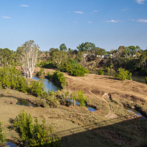
The Plane Creek Basin is unique in that it encompasses a number of smaller waterways over its 2,538 km2 area, rather than one or two larger rivers like the other basins in the Mackay-Whitsunday region. The basin includes Sandy Creek in the north and extends south to include Plane, Rocky Dam, Cape, Marion, Flaggy Rock, and Carmila Creeks, which drain into Sarina Inlet, Ince Bay, and Carmila Coast receiving waters. The basin is bordered by the Connors Range in the west.
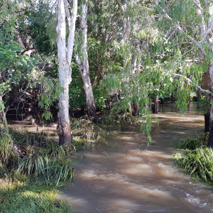
Approximately 11% of the Plane Creek basin is part of a wetland system. Of this, 17.3% are riverine systems, 6.1% are artificial and highly modified systems, 67.2% are estuarine systems and 9.4% are palustrine systems.
Within the Plane Creek basin, 33 species of plant and animal are endemic to Queensland. Nine vulnerable species, four endangered species and three critically endangered species exist in the area. Two of the critically endangered species, the eastern curlew and curlew sandpiper, are migratory shorebirds that rely on coastal wetlands. The endangered northern quoll is also found in the area.
The major township of Sarina is situated on the lower part of Plane Creek and the basin includes both the Mackay Regional Council and Isaac Regional Council local government areas.
While the major land use in the basin is grazing, the Plane Creek basin has the highest area of sugarcane farming across the Mackay-Whitsunday-Isaac Region, which is primarily in the north of the basin. There are also small areas of forestry and conservation in the basin.
This map journal produced by the Queensland Government and a range of regional stakeholders provides a wealth of information on the Plane catchment.
Area
2,538 km2
Major towns
Sarina and Carmila
Land use
Mixture- grazing in the south is the major land use, closely followed by sugarcane farming in the north.
The Plane Basin has the most sugarcane farming in all of the Mackay-Whitsunday-Isaac Region. There is also a small amount of forestry and conservation.
Major rivers
Sandy Creek, Plane Creek, Rocky Dam Creek, Cape Creek, Marion Creek, Flaggy Rock Creek and Carmila Creek.
Wetland area
276.7 km2
Biodiversity
1770 native species/vagrants, 34 QLD endemic species, nine Vulnerable, four Endangered, three Critically Endangered (EPBC Act 1999)
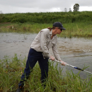
Grower-led Water Quality Monitoring in Sandy Creek
Concerned sugarcane growers in the Sandy Creek area initiated a water quality monitoring program in 2015 in response to high pesticide concentrations detected in routine catchment monitoring programs. Find out more about the project here.
This program is now facilitated by Reef Catchments.