Southern Seagrass Scores Explained
Seagrass in the Southern Inshore Marine Zone (between Cape Palmerston, south of Sarina, and Clairview Bluff) was reported on for the first time in the 2021 Report Card.
So what were the scores and what do they tell us?
What we found
Researchers from JCU Tropwater, University of Queensland and Australian Institute of Marine Science (AIMS) completed monitoring and data collection on three coastal meadows, between 2017 and 2021.
Surveys focused on gathering data on above-ground biomass, meadow area and species composition. Four species of seagrass were found, however only thin leaf varieties of Z. capricorni and H. uninervis were recorded.
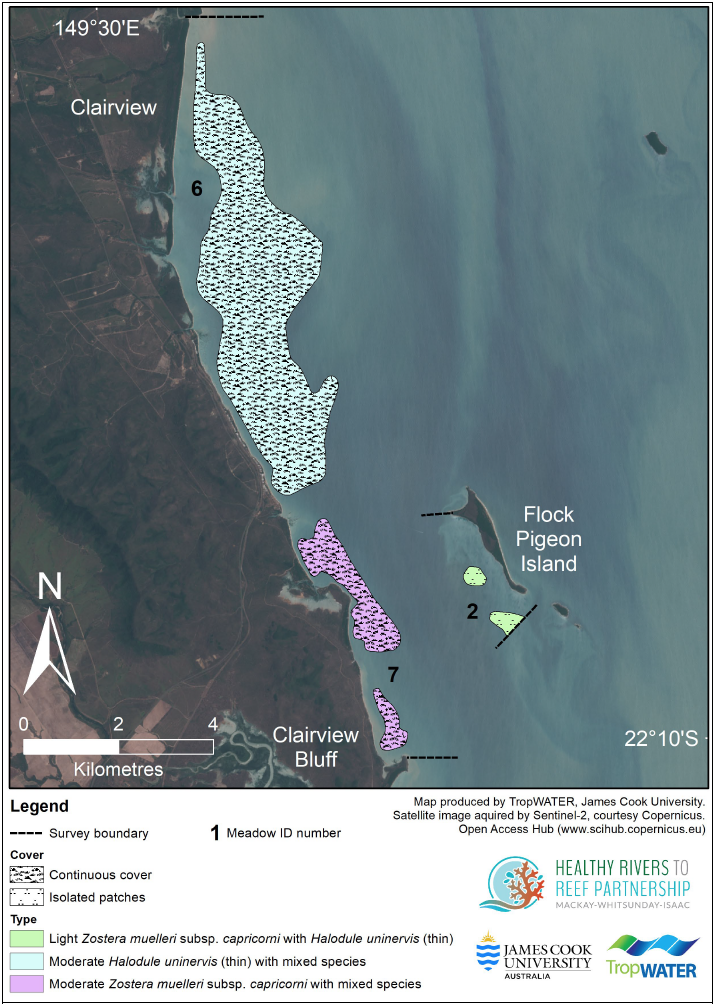
Two coastal meadows, between Clairview and Clairview Bluff, were larger and had continuous cover, while the site at Flock Pigeon Island had isolated patches. Dugong feeding trails were abundant in the inshore meadows and areas with higher biomass.

Seagrass meadows within the Southern Inshore Monitoring Program area, showing seagrass density and species composition. © James Cook University 2021. Reproduced with permission.
Scores explained
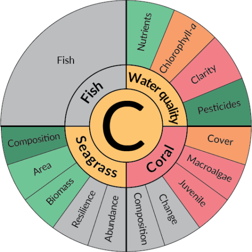
Overall, seagrass in the Southern Inshore Marine zone scored a ‘C’ in the 2021 Report Card. At first glance, you might be wondering why seagrass received this grade when composition, area and biomass all scored ‘Good’ and ‘Very Good’.


2021 Report Card: Southern Inshore Marine Zone Grade.
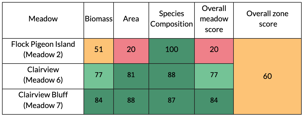
Unlike other indices in the report card, the score for seagrass was not calculated by averaging its indicator scores (biomass, area and composition). Instead, each meadow was given an overall score, based on its lowest scoring indicator. These meadow scores were then averaged to arrive at the overall grade for seagrass in the Southern Inshore Marine Zone.
As you can see in the table below, the two larger meadows with continuous coverage scored ‘good’ and ‘very good’ for all three indicators. The meadow at Flock Pigeon Island, scored ‘moderate’ and ‘poor’ for biomass and area, which lowered the overall zone grade.

2021 Report Card: Site specific seagrass scores for the three meadows in the Southern Inshore Marine Zone.
Refining the baseline
We are able to report on seagrass in the Southern Inshore Marine Zone for the first time in 2021, due to five years of data collection forming a baseline for the condition of seagrass in this area. This data collection was made possible thanks to the Southern Inshore Monitoring Program funded by Dalrymple Bay Terminal and Dalrymple Bay Infrastructure.
However, as you can see from the example at Flock Pigeon Island, the five-year baseline has the potential to be refined as we learn about the natural condition of each site.
Another five years of data (10 years of total monitoring) should give us a more accurate baseline for measuring changes in seagrass health, and understanding the influence of climate patterns and extreme weather events.
If baselines are adjusted, we may see grade improvements over the next few years.


